NATIONAL DEFENSE
Space is not the place to win a nuclear war. Earth is.
We deliver engineering and strategy innovation to turn customer need into commercial and government solutions.
The missiles and jets that Russia or other enemies will use against the US and NATO are not parked in space. They initiate here, on earth.
And they still use, for a little while longer, US Military GPS navigational signal from Peterson AFB in Colorado Springs. The older the rocker or jet model, the less able it is to even launch without a GPS signal lock-on. The newer models mix GPX with inertial guidance or pre-programmed computing scripts, but they still use GPS at some point before boosting out of atmosphere, to orient themselves and calculate their re-entry position and speed adjustments.
Why enable any part of this deadly trajectory? The US still 'owns' in some measure, every enemy's flight between earth and space.


For decades, the US owned the world's only global navigational system. In 2025, that advantage is gone.
GPS was invented by the US in 1973, to improve on earlier star- or script-based navigational systems. In 1995, President Carter shared GPS with the world, to improve commercial air travel safety. Under President Obama, GPS codes and design were shared with China and other military enemies. And keeping GPS free and open to 'all' has been a US Democratic party pledge.
Unfortunately, keeping GPS open and its codes and designs shared with 'everyone' had the unintended consequence of seriously undermining US, NATO, and other allied security.
How relevant is US GPS in 2025 to US and Allied National Security? Still very relevant.
Fortunately, missiles, drones, and jets are not like personal cell phones. Countries cannot afford to replace them every 1-2 years. Russia, North Korea, Iran, Hezbollah and other enemies have fleets and missile supplies that are old enough to utilize GPS and not modern enough to be compatible with Beidou.
- In 2000, China launched Beidou, its counterpart to US GPS. Beidou’s Radio Determination Satellite Service (RDSS) combines PNT (position, navigation, & timing) signal with short SMS and listening-in capabilities. And is generally faster and more accurate than GPS.
- Russia's Glonass PNT system, also created in the 1970s, is similar to GPS, but Russia has struggled with timing accuracy and as a result used GPS more.
- In 2016, Iran launched a terrestrial alternative to GPS called
Nasir 1, satellite-based. But its system still relies in part on GPS guidance.
- Enhanced LORAN (eLORAN) and Loran C are slightly updated, more accurate versions of LORAN radio frequency navigation developed by the US in WWII. North Korea and Russia have both used Loran and GPS for their older model rockets and military fleet.

Every military has the same basic needs: fuel, manpower, and navigational guidance. Just as every wildfire needs the same three elements: fuel, oxygen, and heat.
Strategic Innovation means figuring out how to impact one of these same basic needs differently, or how to impact other or more basic needs, than you could before.
An estimated 88% of Russian guided attacks on the Ukraine used US GPS. So let's cut off US GPS. (Again)

Only the S-300/400 are not GPS-compatible. Ukrainian and US military observers and UN teams have reported that overwhelmingly, Russian guided missiles, drones, and jets showed US-made electronic components, including GPS guidance chips and receivers. This is despite Russian President Putin telling global media before he attacked the Ukraine, that he would switch all of his miliitary guidance to US-made Loran radio frequency guidance, to attack; to avoid US military interference in Russian launch or trajectories.
A red herring, obviously; but also an indication that Russia - as with Iran and other enemies - feared and expected the US to respond to missile, or drone attacks by blocking GPS signal or acquiring and impacting Russian / enemy weapon or drone trajectories. Tactics the US used on two previous occasions in the 1990s against China: once to avert a Chinese missile attack against Taiwan, and once to force a Chinese ship carrying chemical weapons to India to turn back to China.
Since 2017, DC Strategic Group has lobbied fiercely for the US to restore these two pilot tactics, working with former US military and national intelligence teams to continually monitor and research Russian, Iranian, and other enemy missile and drone guidance systems; and to design updated engineering capabilties to let the US selectively secure its own GPS against their use; and to develop other capabilities to destabalize enemy guided missile or UAV flight, launch, and target acquisition.

Targeting the Full Flight Path
There are 4 distinct stages in most missile or UAV attack sequences:
awake and load target,
launch, flight to target, and terminal phase (detonation).
Every existing or planned missile defense system targets only the last two phases: except ours. Since 2017, our CEO has led concept and engineering design for missile & satellite defense.

Gyroscopic Destabalization
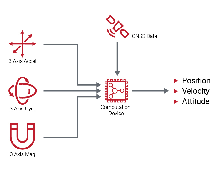
The main advantage of high-end gyroscopes in space, missile, and hypersonic flight performance is their support for unaided inertial navigation, also known as dead-reckoning. We offer engineering design and product development to support new capabilities into protection and destabalization of sophisticate flight & guidance mechanics.

White Hat Cyber Intervention
The US controls and/or has monitoring access to ground stations used by Russia and China worldwide. We were one of the first US Military contractors to ask the question, "How can we best make use of this physical & computing access?"
